Toubkal Group Ascent

In a Few Words

From Tizi Oussem to Aremd, we follow the ancestral trails of the High Atlas to reach the legendary highest summit in Morocco — Mount Toubkal. We’ve designed an accessible itinerary with a beautiful acclimatization hike to prepare you for the climb up to 4,167 m. Reaching the summit, you’ll be rewarded with sweeping views over the entire High Atlas.

The landscapes you’ll cross vary with each slope and altitude: sometimes a forest of holm oaks, sometimes juniper groves, sometimes the cool freshness of a waterfall cascading down the rocks, sometimes the deep red of the earth, a pisé village clinging to a hillside, a shepherd’s hut, and in the distance the imposing silhouette of a mythical summit…

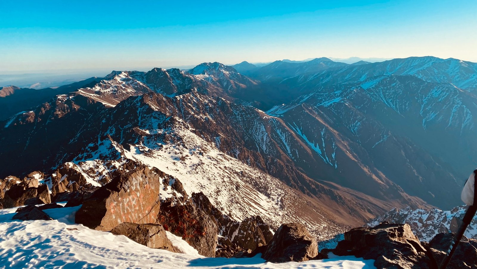
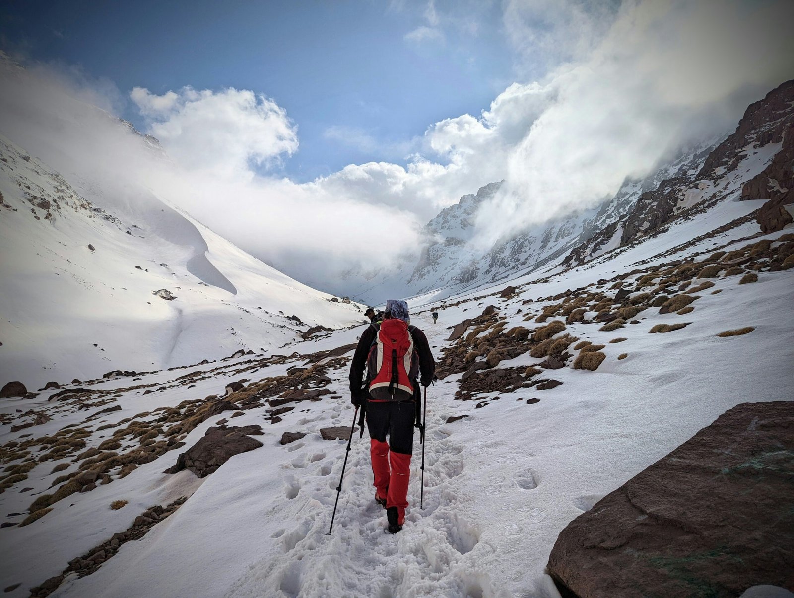
Step by step, we draw closer to Toubkal. From the Neltner base camp, just 1,000 m of elevation separate us from the summit — a 4,000m peak with no technical difficulty, and the promise of unforgettable emotions for those who attempt it. From the top, the view opens wide: the Siroua massif, the Imlil Valley plunging below, and the infinite horizon beyond.

Highlights

  • Our Berber guide and his expert ascent team
  • A gradual, well-paced approach hike
  • Striking contrasts between the colors of the earth, the crops, and the peaks

Level

5 to 6 hours of walking or physical activity per day. In the mountains, elevation gain ranges between 500 and 800 m per day, with possible altitudes of around 3,000 m. Toubkal summit at 4,167 m.

This trip is accessible if you regularly practice a physical activity — and the vast majority of travelers do reach the summit.

Group Travel

Want to travel but not alone? Join a group for your next active retreat! It’s the ideal trip for solo travelers or duos wanting to share the experience with others and let themselves be guided.

Included/Excluded

  • All local transfers
  • Accommodation in shared room or tent
  • Full board (except in Marrakech)
  • Local team: drivers, muleteers, and cook
  • A French-speaking Berber guide
  • Round-trip flight to Marrakech
  • Personal expenses
  • Drinks
  • Meals in Marrakech
  • Tips for the local team (at your discretion)

Tour Plan

1 Flight to Marrakech (custom flight not included — contact us)
  • Breakfast: not included
  • Lunch: not included
  • Dinner: not included

Free arrival in Marrakech, on this day or a few days earlier depending on your preference and the flight you find. We can of course handle your flight and airport pick-up if you wish — just ask us.

2 Marrakech → Imi Oughlad (1,355 m) → Tizi N'Techt (2,000 m) → Tizi Oussem (1,800 m)
  • Transport: 1h30 — 58 km
  • Activity: 5h walking
  • Elevation gain: +643 m
  • Elevation loss: -300 m
  • Max altitude: 2,000 m
  • All meals included

A short 2-hour transfer to Imi Oughlad, where we meet our muleteer team who will accompany us on this adventure. We begin our hike through a forest of holm oaks, then the climb truly starts as we make our way up to Tizi N'Techt. Along the way, we pass through numerous Berber villages perched on the mountainsides — some built from earth, some from pisé (rammed earth), but always with that magnificent red color of laterite soil. Our first bivouac is set up under the trees, alongside the N'Ouazzaden River, near the village of Tizi Oussem.

3 Tizi Oussem → Tazaghart-Lepiney Refuge (3,030 m)
  • Activity: 5h walking
  • Elevation gain: +1,230 m
  • Max altitude: 3,030 m
  • All meals included

We continue our gradual ascent among juniper trees. Berber villages give way to high-altitude shepherd huts and terraced fields. We pass through the Tamsoult shepherd huts and the Ighoulidem waterfalls, eventually reaching the Tazaghart Refuge, where we set up our bivouac. The vegetation thins as we enter the high-altitude desert.

4 Tazaghart Refuge → Tizi Aguelzim (3,550 m) → Neltner Refuge (3,207 m)
  • Activity: 5h walking
  • Elevation gain: +670 m
  • Elevation loss: -343 m
  • Max altitude: 3,550 m
  • All meals included

A full day of walking to reach the Toubkal base camp. We zigzag up to 3,550 m at the Aguelzim Pass, where we enjoy a spectacular view over the entire massif, then descend to the Toubkal Refuge where we bivouac for the night.

For those who wish, an optional afternoon hike to the Ouanoums Pass (3,650 m) offers a beautiful view of the southern face of Toubkal and Lake Ifni (2h30 to 3h walking, +450 m / -450 m).

5 Ascent of the Highest Peak in North Africa: Toubkal
  • Activity: 6h
  • Elevation gain: +960 m
  • Elevation loss: -960 m
  • Max altitude: 4,167 m
  • All meals included

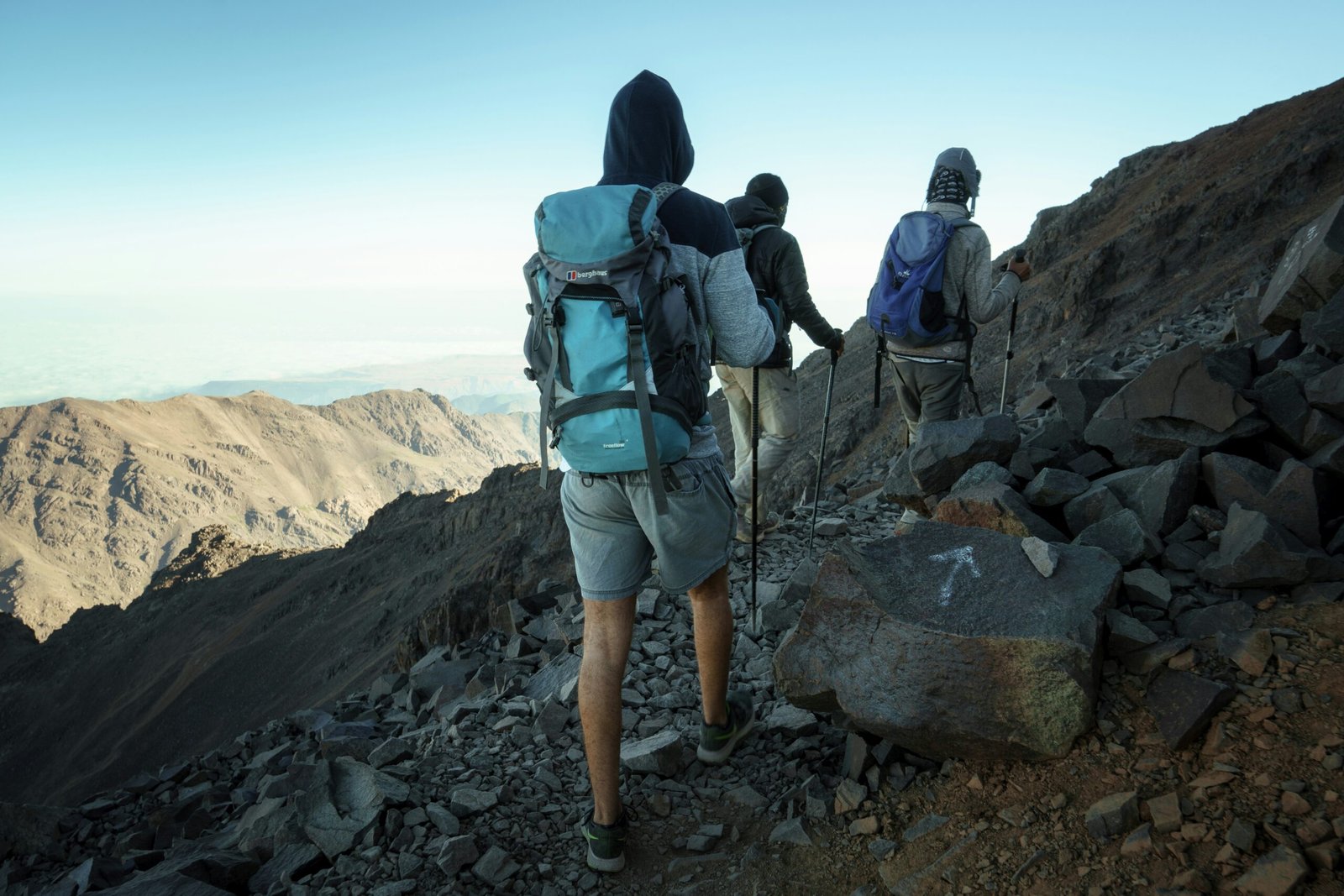
Early start (between 5:00 and 5:30 AM) for the ascent of Toubkal at 4,167 m — the highest peak in Morocco and North Africa. For many, this is the chance to summit their first 4,000m peak in relative ease.

From the top, you'll dominate a large part of the Atlas range, with the plains and desert visible on the distant horizon. The summit offers a breathtaking view of the Siroua Massif and the Imlil Valley.

(Summit ascent is optional.)

6 Neltner Refuge → Aremd (1,904 m)
  • Activity: 4h walking
  • Elevation loss: -1,300 m
  • All meals included

We descend toward the village of Aremd, passing by the valley's marabout, Sidi Chamharouch. Upon arrival at the village, we say goodbye to our muleteer team. In the afternoon, there's time for an optional short walk around the area.

7 Aremd → Marrakech
  • Transport: 2h — 64 km
  • Elevation loss: -200 m
  • Max altitude: 1,900 m
  • Breakfast: included
  • Lunch: not included
  • Dinner: not included

In the morning, we walk to Imlil (about 1 hour), where we meet our vehicles for the return to Marrakech. Check-in at the hotel, with the possibility to explore the city. Meals are on your own.

8 Return Flight (custom flight not included — contact us)
  • Breakfast: included
  • Lunch: not included
  • Dinner: not included

Departure after breakfast. If you'd like to extend your trip, we'd be happy to explore the different options with you — just speak to your travel expert!


A few small notes:

  • "Marabout" = a saint's shrine/tomb in North African Islamic tradition. I kept "marabout" since it's the proper term, but you could write "saint's shrine of Sidi Chamharouch" if your audience is unfamiliar
  • "Pisé" = rammed earth construction technique. I kept it with a brief parenthetical explanation
  • "Laterite" = the iron-rich red soil typical of the High Atlas. Kept the geological term
  • The price isn't listed — definitely add it for the booking page
  • I noticed Day 4's optional Ouanoums Pass altitude (3,650 m) is slightly different from the daily max (3,550 m). Worth double-checking — Ouanoums is usually listed as ~3,664 m
  • Toubkal summit is officially 4,167 m (some sources say 4,165 m) — your number is correct
  • "Lepiney" in the refuge name refers to the French climber Jacques de Lepiney — kept the historical name intact

Thanks for your review!

Your feedback helps us improve our service.

error

Please Insert Review Title

Please Insert Review Feedback

From
6,750.00 MAD
Booking Form
Request Form

Guests

0

Adults

6,750.00 MAD

Children

0.00 MAD

Babies

0.00 MAD
Available:
Total:

Guests

0

Adults

6,750.00 MAD

Children

0.00 MAD

Babies

0.00 MAD